A New Map Of Medieval London
A New Map Of Medieval London
https://londonist.substack.com/p/a-new-map-of-medieval-london
Deliciously detailed 13th century plan. And a Tudor one, too.
Zoomable, translated version of the 15th century Mappa Mundi
Explore - Fra Mauro
https://mostre.museogalileo.it/framauro/en/interactive-exploration/explore.html
Measuring the Shape of the Earth | History Today
Measuring the Shape of the Earth | History Today
https://www.historytoday.com/archive/great-debates/measuring-shape-earth
Why Swiss maps are full of hidden secrets
Why Swiss maps are full of hidden secrets
https://bigthink.com/strange-maps/swiss-maps/
Cartography is serious business in Switzerland — but once in a while, the occasional map gag slips through.

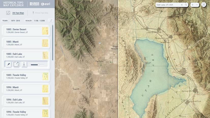
Access Over 181,000 USGS Historical Topographic Maps
Access Over 181,000 USGS Historical Topographic Maps
https://www.esri.com/arcgis-blog/products/arcgis-living-atlas/mapping/access-over-181000-usgs-historical-topographic-maps/
We recently updated our online USGS historical topographic map collection with over 1,745 new maps for a new total of over 181,000 maps.
Oculi Mundi
Home | Oculi Mundi
https://oculi-mundi.com/
A destination for discovery, shared exploration, and sheer joy, Oculi Mundi is the online home of The Sunderland Collection of antique maps and atlases.

Visualising History: The Spread of European Printing Activity (1450-1650). Mapped!
Visualising History
https://arts.st-andrews.ac.uk/visualisinghistory/posts/the-spread-of-european-printing-activity-1450-1650-mapped
CC0-licensed fantasy map brushes based on historical cartography
Fantasy Map Brushes
https://kmalexander.com/free-stuff/fantasy-map-brushes/
Welcome to a project I call #NoBadMaps. Here you will find brush sets and tools to create fantasy maps that can add a touch of historical authenticity to any project. All my brushes are released un…
