Metropolitan Transportation Plan Update - ARC
Metropolitan Transportation Plan Update - ARC
https://atlantaregional.org/the-atlanta-regions-plan/mtp-update/
ARC is updating its long-range blueprint guiding transportation investments through 2050, covering 20 counties in the Atlanta MPO.
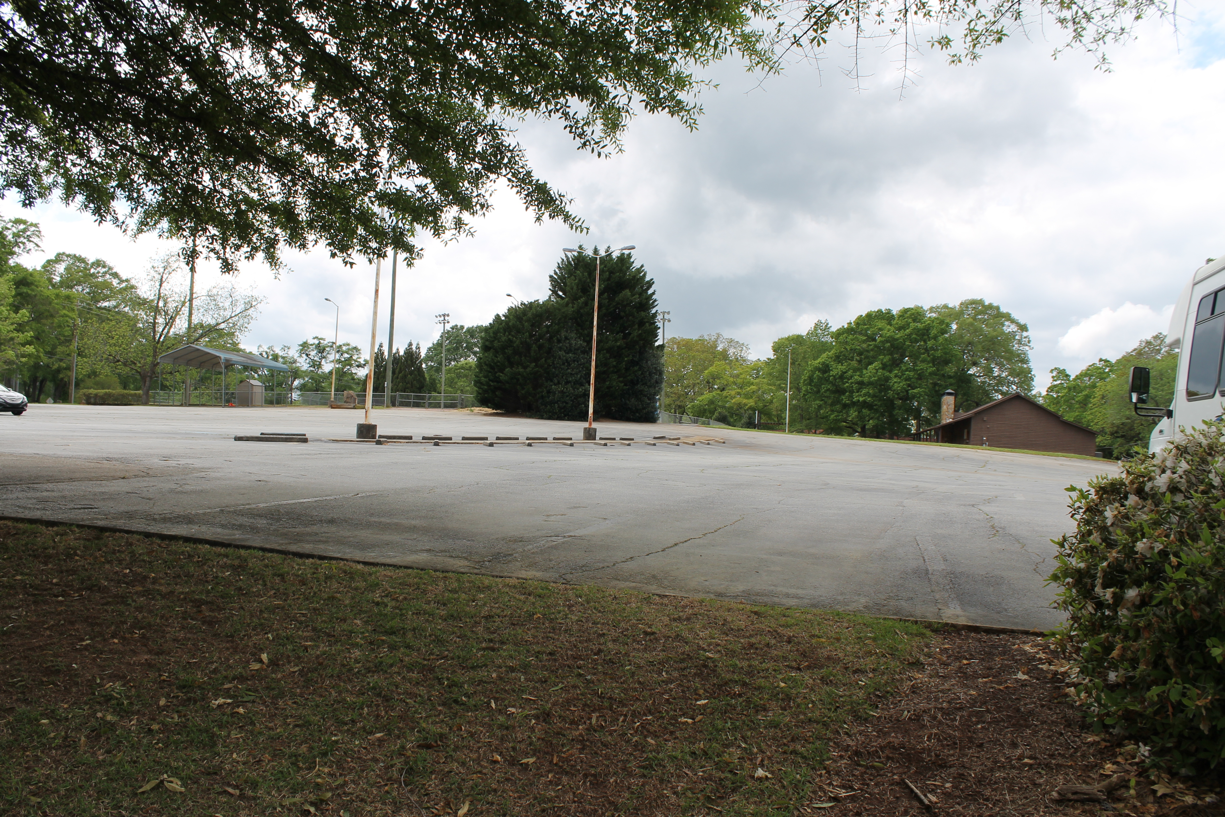
Downtown Desolation Parking Rows in Smyrna
Downtown Desolation Parking Rows
https://smyrnacitizen.home.blog/2023/06/12/downtown-desolation-parking-rows/
Map created by Tyler Bigler If Smyrna wants a vibrant, lively, and exciting downtown, the City should address the excessive parking lots that dominate our city center. But first, a shoutout to Tyle…
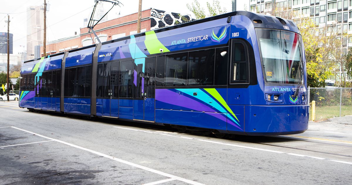
MARTA approves design contract for streetcar expansion
GDPR Support
https://www.ajc.com/neighborhoods/atlanta-intown/marta-approves-design-contract-for-streetcar-expansion/6BFIE3LIXRCQBKKTYJBOFBPOPQ/
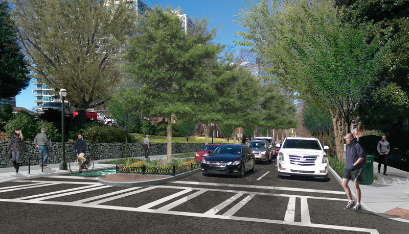
Feds award $25M to ramp up Beltline construction
GDPR Support
https://www.ajc.com/news/atlanta-news/feds-award-25m-to-ramp-up-beltline-construction/4G2EP6YP25FJLBZY6XVSAFO4RY/

Zoning for safer streets!
Zoning for safer streets!
https://www.threadatl.org/zoning-for-safer-streets/?
Atlanta has a great opportunity to prevent pedestrian violence while also reducing onerous parking requirements — ThreadATL and Propel ATL are asking for your help! Councilmember Jason Dozier is sp…
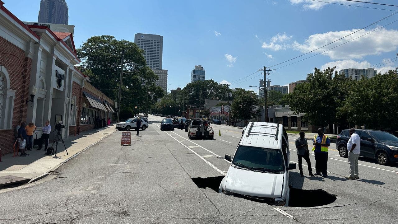
Large hole opens on busy Midtown roadway, swallowing SUV
Repairs continue on sinkhole on busy Midtown roadway
https://www.fox5atlanta.com/news/ponce-de-leon-sinkhole-atlanta
A driver said he thought he hit a typical Atlanta pothole, but knew something was wrong when his car started sinking. Then, he saw water.
Can OpenStreetMap improve transportation in Atlanta?
OpenStreetMap is a internet project that distributes free geographical data to the world. It relies on a community of volunteer editors to keep the information up to date.
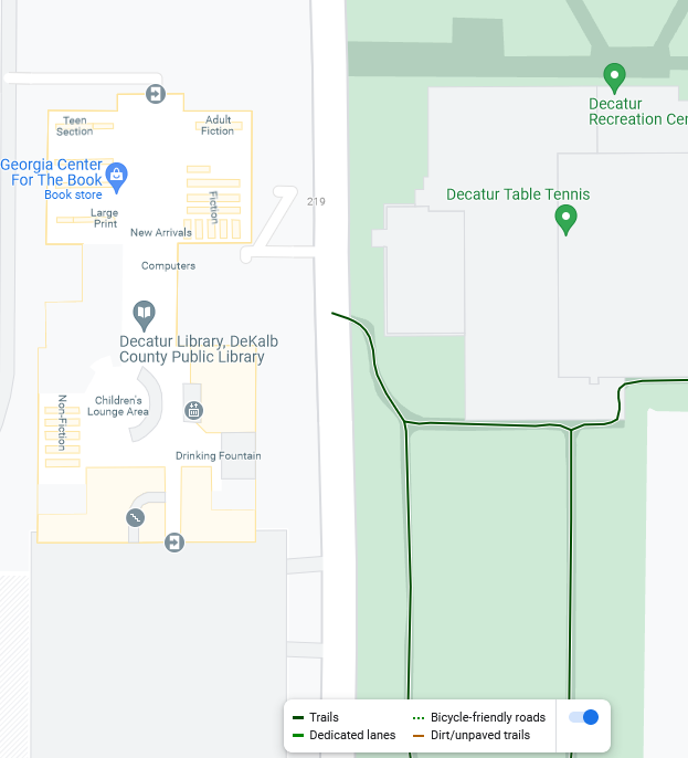
One benefit of OSM is that it allows groups of editors to decide what matters to them and add the features to the map, rather than hoping that some corporation decides that a feature is profitable enough. For instance, OSM shows the location of bike racks near the Decatur Library, and properly notes that the paths through Scott Park are foot-paths.
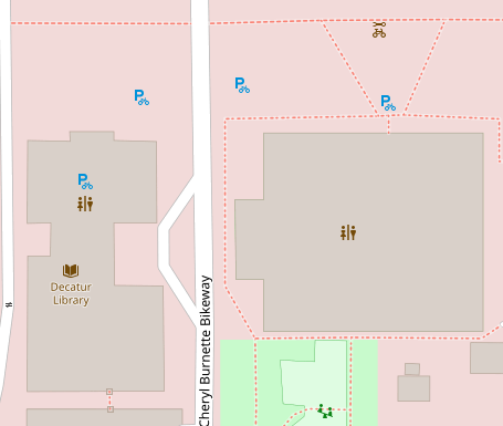
In contrast, the Google Maps "bicycle" layer does not include bike racks and highlights those footpaths as though they are appropriate for biking (despite being right next to a building with multiple doorways and sharp turns with no visibility)
Still, OSM is not perfect -- I had no problem finding information that was right in Google Maps that was wrong in OSM (and vice versa). I figure that Google benefits either from web-scraping and more automation, or perhaps from more user feedback. OSM requires more effort, but this also means it gives us greater input over it's content (and has greater curation to avoid idiotic AI stuff). I signed up and made some edits myself -- OSM has a good editing interface and a good walkthrough tutorial.
But I think the most important aspect is that OSM is free (as in speech), which means anybody can copy it and no single entity can just hide or discard all the data when it no longer fits in their business strategy.
I found two cycling based projects based off of OSM: https://www.opencyclemap.org/ and https://www.cyclosm.org/. These are also shown in the "Layers" on OSM:
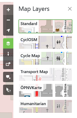
The maps displays are pretty complex, and I'm not sure if there's an easy app for planning your route using these data.
I also found a project focused on wheelchair accessibility when I looked at the "history" view and saw that someone has been editing the decatur map from https://wheelmap.org/.
So the end question is whether this map data can end up being helpful to both personal transportation and transportation advocacy in Atlanta. I'd love to hear any thoughts on this topic.